

Background
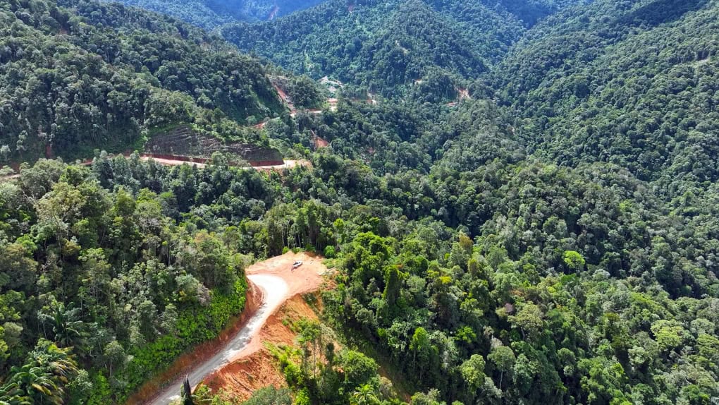
The Sarawak Sabah Link Road Phase 2 (SSLR2) is the first continuous land link between the remote East Malaysian states of Sarawak and Sabah. Running 335 kilometres through Limbang, Lawas and the northern Sarawak interior, it is intended to give more than 70,000 residents of underserved communities year-round access to schools, hospitals and jobs, and to open a region with significant agricultural and tourism potential. The need for a year-round connector became acute during the pandemic, when international border closures cut these communities off overnight.
Delivery is led by Jabatan Kerja Raya Sarawak (JKRS), the state public works department, on a federally approved budget of MYR 7.15 billion. Construction started in June 2024 against a 60-month programme, with completion expected in June 2029.
Why a digital-first approach
The corridor crosses mountainous terrain with widely varying soil conditions and some of the heaviest rainfall in Malaysia. Teams work across hard-to-reach sites, alongside protected areas and timber concessions, and under frequent design changes and community scrutiny. With only 60 months to deliver, JKRS moved off traditional 2D drawing workflows and basic file sharing onto an integrated 3D and 4D digital twin environment.
The deployment
- Common data environment — ProjectWise connects design consultants, contractors and government agencies in one traceable repository, tightening document control and shortening design reviews across project zones.
- 3D corridor design — OpenRoads Designer handles geometric alignment, corridor modelling, terrain analysis, drainage design and slope stabilisation planning, letting engineers optimise layouts against geotechnical conditions in real time.
- Geospatial coordination — OpenCities Map layers engineering models over cadastral, utility and environmental datasets, so land acquisition, timber concession boundaries and environmental buffers are resolved with land offices, forestry departments and utility providers before they become site problems.
- 4D construction sequencing — SYNCHRO 4D simulates construction sequences and logistics against real-world site constraints, exposing clashes and informing manpower and plant planning.
- Reality capture — iTwin Capture turns monthly drone surveys into photorealistic 3D reality models of each work front.
- Web-based 3D viewing — Cesium publishes those models to a browser-based 3D visualisation platform, so stakeholders who cannot reach the sites can inspect progress themselves.
Outcomes
Working inside the integrated digital twin platform accelerated the design process by 50% and cut overall project costs by 30%. Coordinating engineering data against environmental and land datasets reduced the impact on protected areas and wildlife by 80%, and the project's carbon footprint fell by 30%. JKRS also reports shorter design cycles, more accurate construction plans and stronger stakeholder engagement, and is exploring carrying the twin forward into the operational phase to manage the completed road through its lifecycle.
Recognition
SSLR2 won the Roads and Highways category of the 2025 Going Digital Awards at Bentley Systems' Year in Infrastructure event in Amsterdam in October 2025, chosen from close to 250 entries submitted from 47 countries. JKRS Director Cassidy Anak Morris, quoted below, presented the project to the independent judging panel and framed the result as a benchmark for infrastructure delivery across Malaysia.

