

Background
The Sungai Buloh-Serdang-Putrajaya (SSP) line is part of Malaysia's Klang Valley Mass Rapid Transit network, a 52.2 km alignment with 38.7 km of elevated track, 13.5 km of underground track and 35 stations serving Kuala Lumpur and its southern suburbs. MMC Gamuda KVMRT (T) Sdn Bhd, the joint-venture turnkey contractor, was responsible for the underground works: twin-bored tunnels along the full underground alignment and 17 individual construction sites, the largest exceeding 17,000 sq m.
The US$7.5 billion project sat in a congested city centre, with tight site constraints, many stakeholders and strict regulatory reporting. Conventional ground survey could not keep pace, so the contractor built a reality-capture workflow around drone photography, photogrammetric 3D modelling and a shared online model library.
Capturing the sites from the air
Survey crews flew drones on pre-determined flight paths at varying elevations, using ground control points to produce accurate georeferenced imagery along the tunnel alignment between the Chan Sow Lin and Bandar Malaysia North stations. Ronan Collins, who led project information management, described the capture kit in a 2017 account of the workflow as a DJI Phantom 4 Pro; a site photograph published with the case study shows a Phantom-series quadcopter flying over a fenced worksite in central Kuala Lumpur.
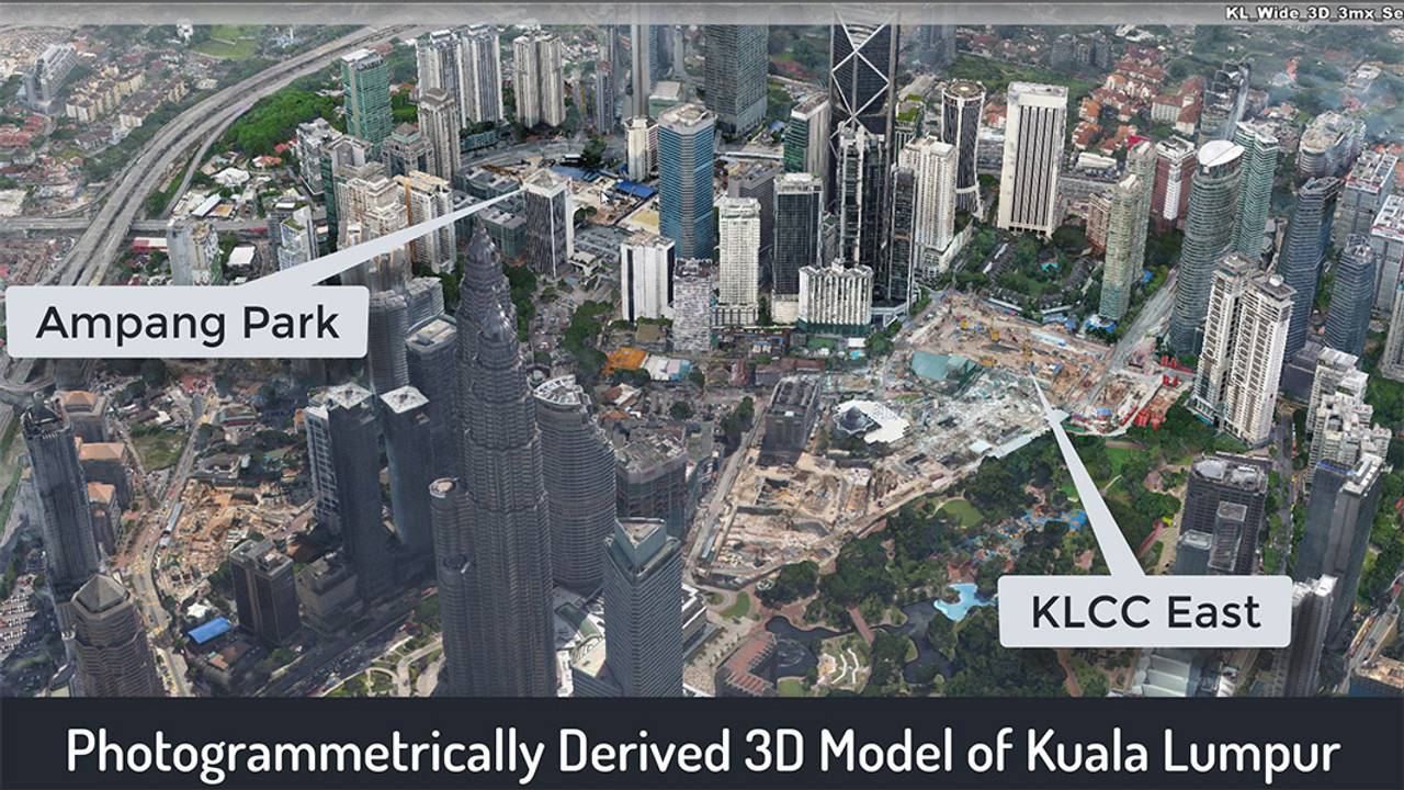
The imagery was processed with ContextCapture into 3D reality meshes, and assembled into a photogrammetric 3D model of Kuala Lumpur that gave every construction site a wider city context. The meshes were accurate enough to position tunnel boring machines relative to the structures above them, and a sequence of flights over 18 months produced successive 3D models of the Bandar Malaysia North station. Comparing those models supported 4D progress analysis — something a fixed time-lapse camera cannot deliver, because its footage cannot be measured.
Checking design against reality
The photorealistic meshes were folded into MMC Gamuda's federated BIM design models. At Chan Sow Lin station the survey mesh was overlaid on the BIM model to confirm that concrete slabs had been placed as designed. At another station site, overlaying drone orthoimagery on printed records exposed a discrepancy: where the paper record showed an empty pathway, the reality model revealed a substantial undocumented structure directly in the tunnel's path — a conflict that would otherwise have surfaced only once tunnelling reached it.
Measurement moved into the model as well. The team measured a secant pile wall from the modelled piling works, and set a measurement plane and density points to compute cut-and-fill for a 28 m station platform, revising the volume from 11,300 cu m to 9,800 cu m. After a landslide at one site, drones inspected the slope and the resulting model was measured to determine how much concrete had to be removed and where temporary works were needed, with no need to put surveyors on unstable ground.
Getting the models to everyone
Models only pay back if people can reach them. MMC Gamuda ran an open connected data environment on ProjectWise, with a portal that let any project member open a web browser and view any 3D model, and integrations that pushed the models into cloud-based BIM and GIS platforms. With sites spread across the city, senior staff could review current conditions remotely instead of travelling between them. Bentley's wider product set on the project also included AssetWise, ComplyPro, Navigator and OpenRail.
Outcomes
Where a manual survey averaged 200 hours with limited coverage, a drone flight collected hundreds of overlapping photos in under an hour and ContextCapture processed a site in about half a day. The contractor estimated the workflow improved survey productivity 30 to 50 times over traditional methods and saved more than 1,000 resource hours across surveyors, engineers and project managers.
The work won first place in the Reality Modelling category of Bentley Systems' Year in Infrastructure 2019 awards, announced at Marina Bay Sands in Singapore in October 2019 after MMC Gamuda was shortlisted that August for "Drone Surveying for BIM and GIS Data Capture". The survey team also began using the same capture for communications, streaming drone footage of the first tunnel boring machine breakthrough online.

