


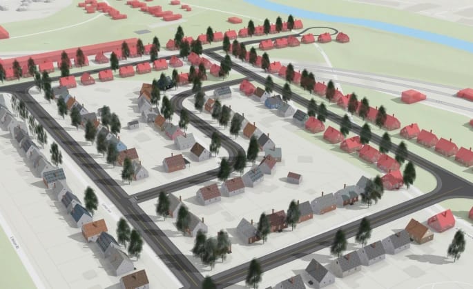
A team of researchers at Ohio State University has spent five years digitally reconstructing demolished Black neighborhoods in Columbus, Ohio, creating detailed 3D virtual reality models of streets and buildings razed to make way for highway construction. The project, called Ghost Neighborhoods of Columbus, focuses on areas including the Carver Addition, Hanford Village, and the Mount Vernon Avenue corridor — communities closely connected to the history of the Tuskegee Airmen who trained at nearby Lockbourne Army Airfield.
Source data comes from Sanborn fire insurance maps, which document American building stock from the 1860s through the 1970s, with approximately 700,000 maps held at the Library of Congress. The team developed machine learning algorithms to automate building extraction from these maps, producing architectural models meeting the LOD3 standard — complete with roofs, windows, and doors. Reconstruction of the Mount Vernon Avenue area alone required around 700 hours of work.
Of the original 35 apartment buildings in Poindexter Village, only two survive today. The goal is to eventually allow community members to explore these lost spaces via laptop, making the digital heritage accessible outside institutional settings. The project is being developed in partnership with local community organisations, including the Poindexter Village African American Museum Project, which is expected to open in 2028. Graduate researchers and community collaborators have contributed oral history and contextual narrative to enrich the spatial reconstructions.


